
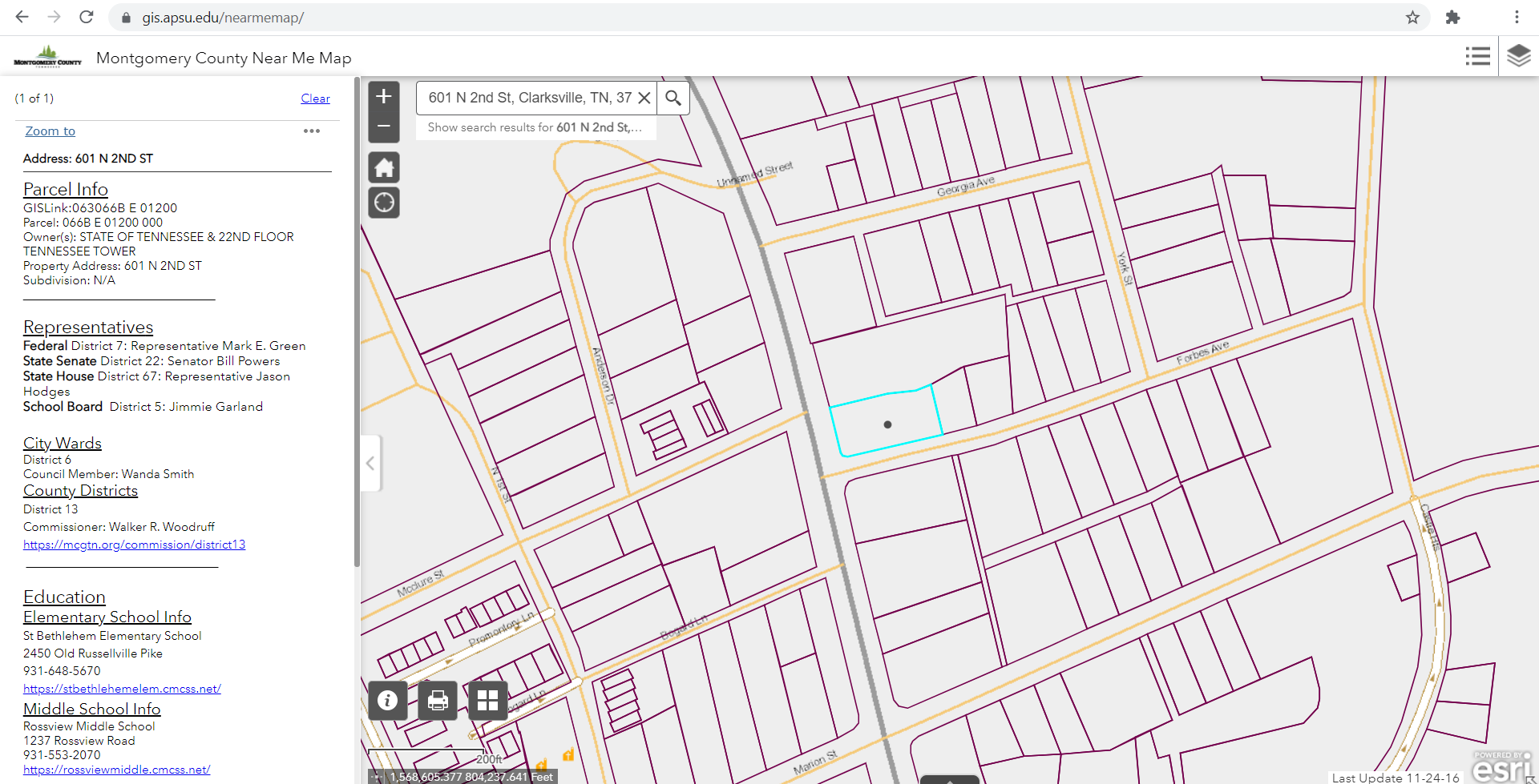
Finished by the GIS center in April of 2021, the Near Me Map is designed to help future and current residents of Montgomery County and the City of Clarksville locate various features of their surrounding neighborhoods. Covering the entirety of Montgomery County’s 544 square miles, the Near Me Map features searchability of county aspects via an easy-to-use layering menu. By simply selecting what features you are looking for, the Near Me Map populates all selected items within the distance of your choosing. Items that can be searched and displayed include parks, schools, and even city wards.
According to Mason Cordell, the GIS Center’s Programmer Analyst, the Near Me Map was “initiated by a desire, due to growth within Clarksville, to help attract newcomers and help people who currently live in Clarksville.” The goal is to assist with familiarity of the county and the availability of features in a given area. The displayed features can help newcomers do things such as determine the correct neighborhood to move to due to proximity of schools, churches, and other ease of access neighborhood elements.
Initiated in 2019, the Near Me Map took a pause in its production due to COVID-19. However, the GIS Center, with the help of student worker Brady Rhoton, was able to pick back up with the project in January 2021, and as of April, launched the map. Future updates the team hopes to push out include the ability to display detailed park amenities on the map.
The Near Me Map is a great tool for exploring characteristics of Montgomery County. Take a minute to check out this new tool for Montgomery County and prospective families at gis.apsu.edu/nearmemap.
Leave A Comment
You must be logged in to post a comment.