
Maps
The APSU GIS Center provides custom maps for surrounding counties. We work with county officials to develop maps that fill each county’s needs.


Interactive Maps
Our student workers collaborate with full-time staff to create interactive web maps that add value to our community! These maps are commissioned by clients or started by the center.
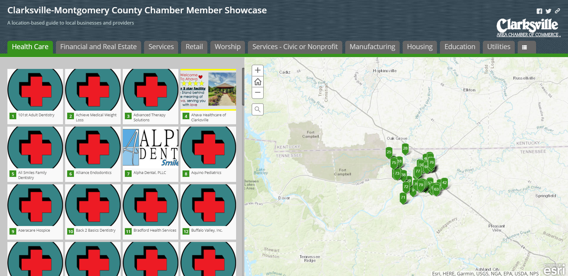
The Clarksville-Montgomery County Chamber Member Showcase is a location-based guide to local businesses and providers.
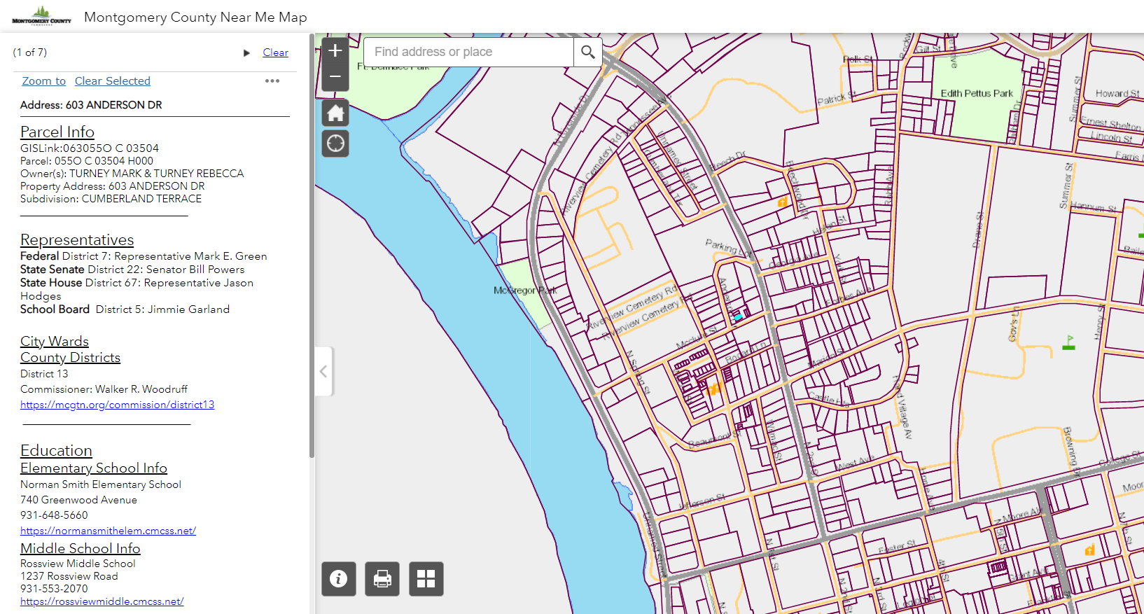
The Montgomery County Near Me Map details representatives, school zones, and proximity to parks and public safety features for parcels.
Student Created StoryMaps
Our student workers create StoryMaps in ArcGIS to benefit the community. Our students collaborate with each other and clients to develop engaging and accurate StoryMaps. Some StoryMaps are completed, while others are updated regularly.
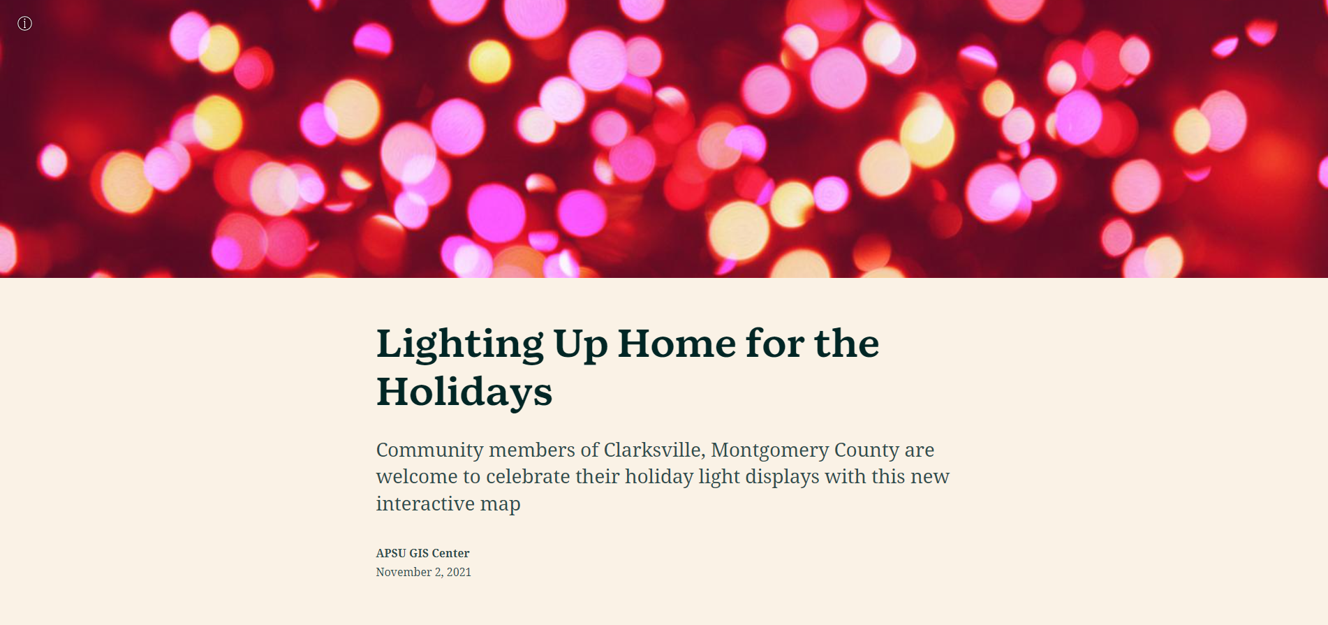
Community members of Clarksville, Montgomery County are welcome to celebrate their holiday light displays with this new interactive map.
Scope out the season’s merry-and-bright streets with this map that updates in real-time. Is there Christmas cheer on your own corner? If you or someone you know has a holiday light display, you can upload a photo and place a tag on the map to share with the community!
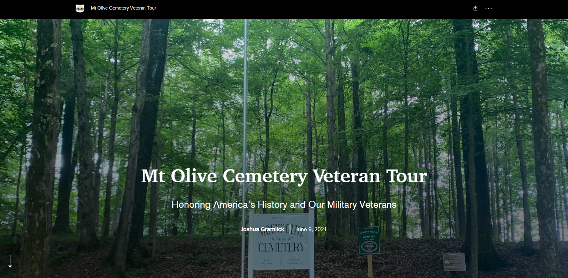
The Mt. Olive Cemetery Veteran Tour was created by Joshua Gramlick. The tour features the graves of African American veterans.

This tour of APSU was created by Rachael Perkins. The tour details the history of APSU.
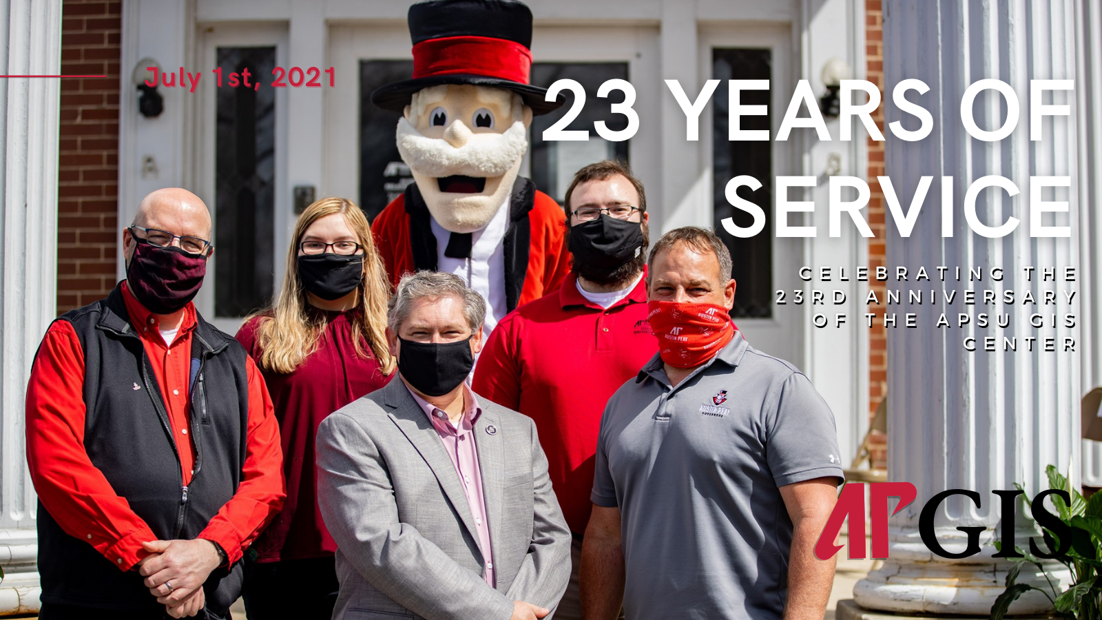
This StoryMap celebrating the 23rd anniversary of the APSU GIS Center was created by Natasha Tice. The StoryMap highlights key moments from the center’s history.
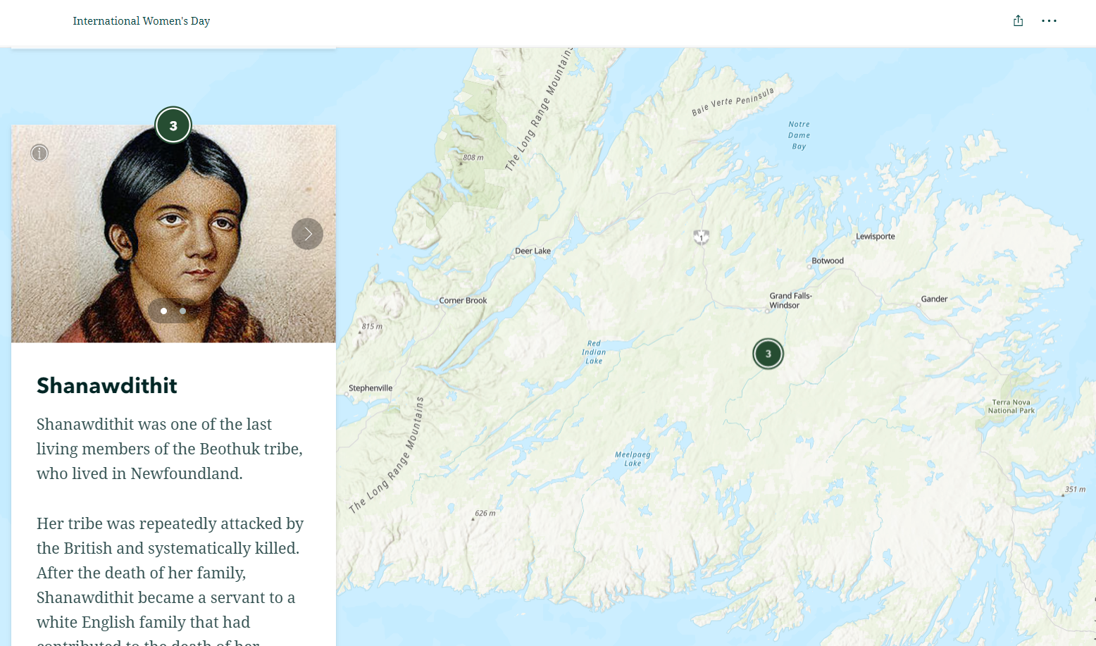
For International Women’s Day, we released this StoryMap featuring some of the many iconic women who contributed to cartography and GIS throughout history.
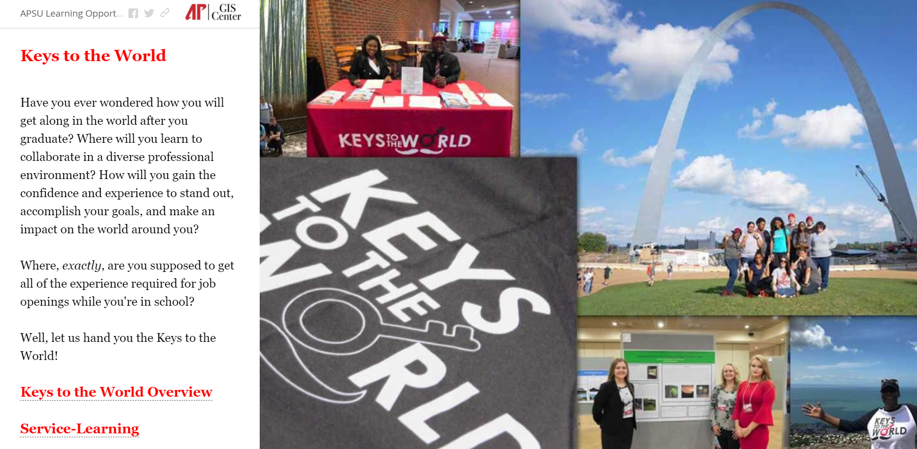
Our Keys to the World StoryMap gives insight into APSU’s study abroad and service learning programs.

This Earth Day focused StoryMap shows how GIS is used to help the environment!
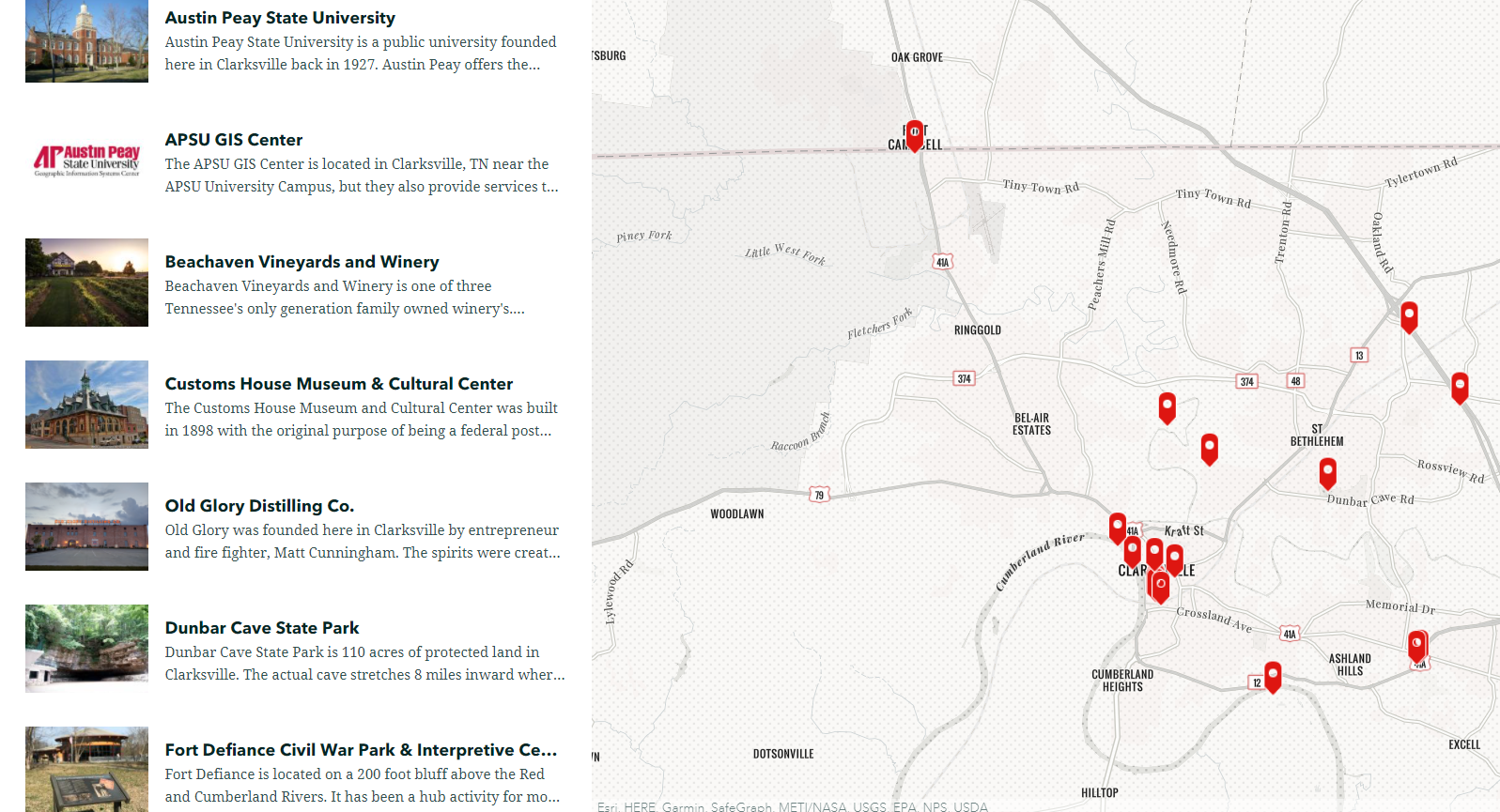
Our Tour of Clarksville features local businesses, parks, and more.