
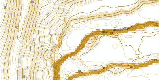
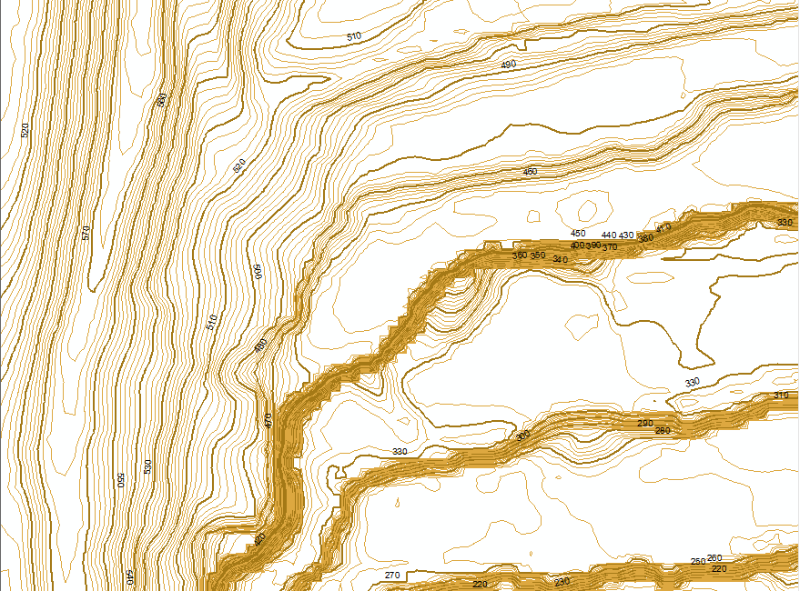
These are contour lines of Montgomery County that [...]
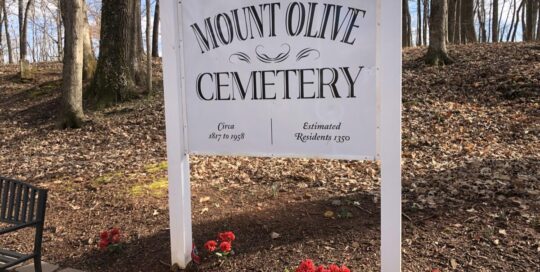
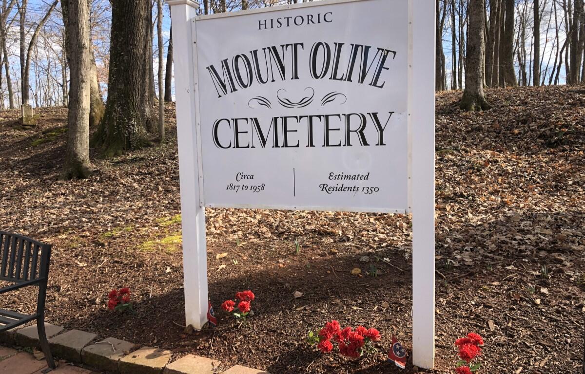
Mt. Olive Cemetery Veterans Tour
Mason Cordell2021-10-27T11:50:25-06:00This is a StoryMap of the Mt. Olive Cemetery Veteran Tour [...]

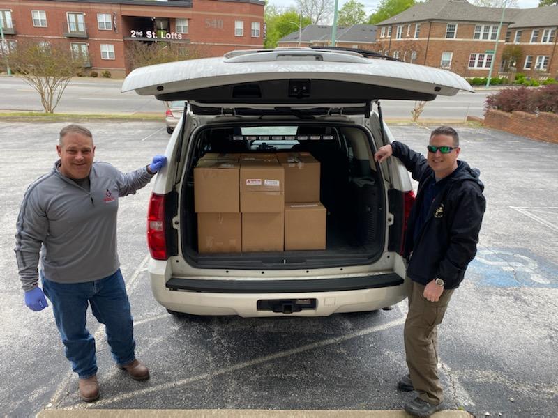
COVID-19 Face Shields
Mason Cordell2022-01-28T09:23:33-06:00The APSU GIS Center is producing acetate face shields to [...]
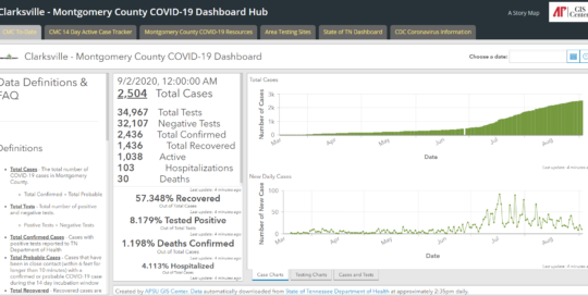
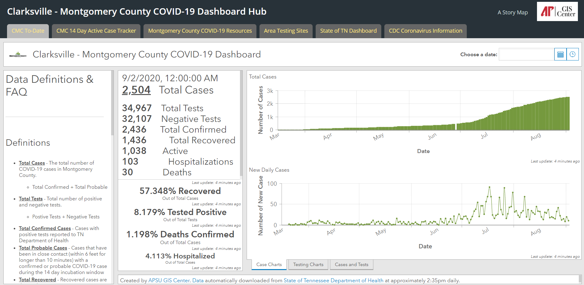
Montgomery County COVID-19 Dashboard
Mason Cordell2022-06-23T09:23:08-06:00The APSU GIS Center worked with Montgomery County officials to [...]
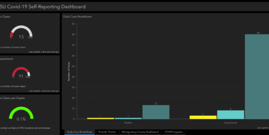
APSU COVID-19 Dashboard
Mason Cordell2022-06-23T09:25:52-06:00The APSU GIS Center created a dashboard to monitor the [...]
Montgomery County Census Viewer
Mason Cordell2022-06-23T09:26:58-06:00Census data is used to make important decisions at the local, state, [...]


Montgomery County Sidewalk ADA Compliance Survey
Mason Cordell2020-08-18T15:26:34-06:00The APSU GIS Center is partnered with Montgomery County and [...]

Austin Peay History Map
Mason Cordell2022-06-23T09:31:45-06:00Austin Peay History Map Austin Peay State University is [...]

Eclipse 2017 and the Peay-clipse
Mason Cordell2021-12-20T11:53:00-06:00ECLIPSE 2017 For the first time in over 40 years, [...]