Skip to content
Search for:
HOME
MAPS
SERVICES AND TECHNOLOGIES
GIS and Technology Solutions
Standard Engravables
Custom Awards
3D Printing
3D Printing and Laser Printing Request Form
OUR WORK
Projects
In The News
Center Blog
WORK WITH US
ABOUT US
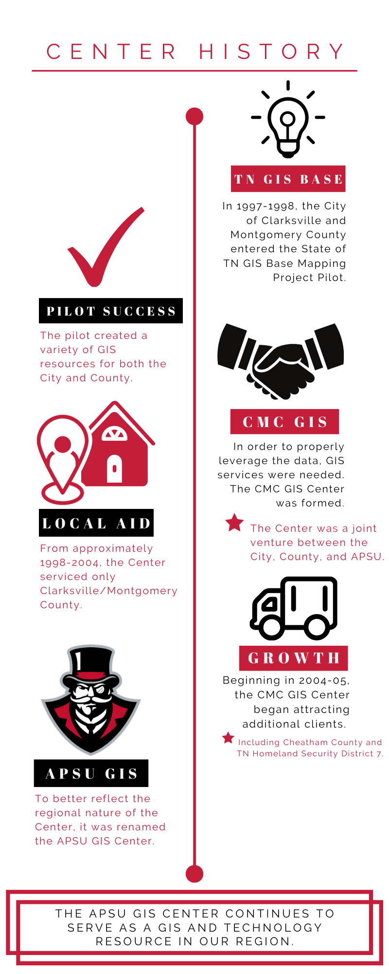
Timeline
Mason Cordell
2020-08-31T13:48:38-06:00
Page load link
Go to Top